Grande Rota da Ria de Aveiro - Percurso Verde - Opinião
A primeira aventura de 2022
Os dias já se notavam a
crescer quando decidimos percorrer uma das mais recentes grandes rotas
em Portugal: a Grande Rota da Ria de Aveiro — Percurso Verde (GR59). A
aventura ficou planeada para um dos primeiros fins de semana com horário
de verão de modo a aproveitar todas as horas de sol. As saudades de
voltar a pedalar de mochila às costas já eram grandes e não queríamos
adiar muito o regresso às aventuras. Como o tempo disponível não era
muito optamos por uma rota que dava para fazer facilmente em 2 dias, e tivesse o início e fim no mesmo local. Desta forma a logística é
bastante mais fácil, pois não dependemos de boleias de terceiros nem dos
horários mais rígidos dos transportes públicos
A Grande Rota da Ria de Aveiro
A nossa rota
Durante o planeamento
da rota decidimos arrancar em Albergaria-a-Velha e terminar em Águeda.
Esta opção implicava um primeiro dia mais longo com 110 km de extensão, mas com pouco desnível, cerca de 1000 D+. O segundo dia, que percorria a
zona mais montanhosa de Sever do Vouga ficou com perto de 83 km de comprimento, mas uns consideráveis 2200 metros de desnível positivo.
Esta divisão do percurso correu bastante bem, pois permitiu-nos chegar ao fim a meio da tarde de domingo.
O Percurso — opinião
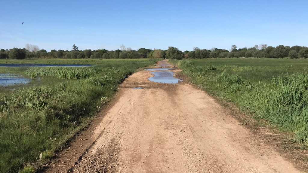
O percurso da GR59 é todo ele ciclável, maioritariamente em alcatrão. Não encontramos grandes dificuldades técnicas dado andarmos muito por estradas secundárias. Qualquer pessoa habituada a andar de bicicleta faz confortavelmente este percurso, seja em 2, seja em três dias, dependendo da capacidade física.
Do ponto de vista pessoal, esta rota deixou um pouco a desejar. Esperávamos um percurso com menos estrada, por trilhos cicláveis, mas que nos permitissem manter afastados do alcatrão. Houve algumas zonas um pouco monótonas, sempre em estradas secundárias de aldeia em aldeia que se tornaram um pouco aborrecidas. A estrada nacional a seguir a Sever do Vouga, apesar de ter o rio ao lado também foi um pouco chata de fazer. Mesmo algumas partes que eram feitas em trilho por estradões florestais estão bem longe da beleza que se vê em outros sítios. Aqui no interior do distrito de Aveiro o eucalipto é o rei e senhor da floresta. Estes eucaliptais não são os sítios mais agradáveis para se andar de bicicleta.
Mas nem tudo foi mau. Adoramos o percurso entre Albergaria e Aveiro, inicialmente por um trilho no meio de campos agrícolas, rodeados de cegonhas, garças e aves de rapina (que não soubemos identificar), e depois por um passadiço em Madeira mesmo junto à Ria de Aveiro. Gostamos especialmente pela biodiversidade que encontramos, bem diferente dos inóspitos eucaliptais. Outra zona que nos agradou bastante foi o percurso entre Sever do Vouga e Albergaria.
Resumidamente, foi um fim de semana bem passado, apesar de o percurso não ter sido o mais agradável, valeu bem a pena ter
saído de casa. Ficou a vontade de conhecer melhor a zona mais perto da
ria de Aveiro. Talvez voltemos um dia para fazer o percurso azul — GR58.
São 130 km com apenas 331 metros de D+ sempre juntinho à ria. Até lá!
Mais informação:
Em torno do principal canal da Ria de Aveiro, cruzando o território dos concelhos de Ovar, Murtosa, Estarreja, Aveiro, Ílhavo e Vagos (e Albergaria-a-Velha, parcialmente).
A GR59 é
a qu...
GR59 - Grande Rota da Ria de Aveiro - Percurso Verde


